Canyonlands National Park
About Canyonlands
Canyonlands National Park is located in southeastern Utah, a few miles away from the city of Moab and Arches National Park. The park is a stunning example of geologic formations. For millions of years layers and layers of sediments were slowly piled on top of each. Around 20 million years ago the ground started to rise in a process called geologic uplift. Finally rivers starting carving out the distinctive canyons revealing the multiple layers of stratified sediments. The confluence of the Green and Colorado rivers is located in the park. This divides Canyonlands into three distinct areas not connected by a road: Island in the Sky, The Needles, and The Maze.


What to Do?
Island in the Sky
Island of the Sky is the most accessible part of the park and therefore the busiest of all three. The hiking in Canyonlands is spectacular. There is a wide array of hikes offering different views and challenges. Some of my favorites were:
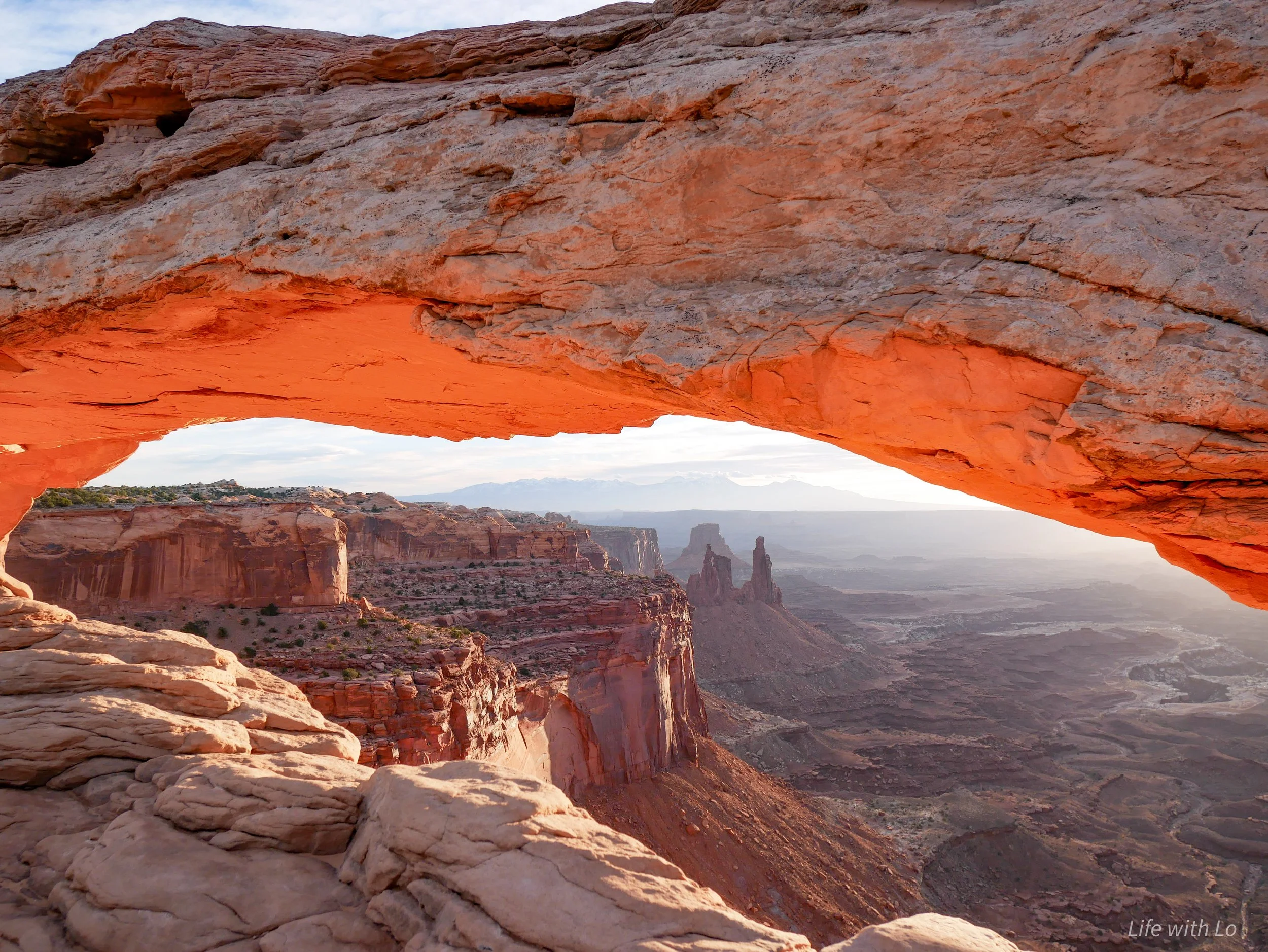
Mesa Arch: 0.6 miles round trip. Elevation gain is 56 feet. This is an easy trail that takes you to one of the most photographed areas in the park. A natural arch formed near the rim of the mesa, where you can look down into the vast canyons.
Upheaval Dome: 1.2 miles round trip with an elevation gain of 114 feet. This is an easy trail that takes you to a scientific mystery in the park. In the center of a circular canyon there are mounds of sediment pushed upwards. One of the theories for how this formation was created is from the impact from a meteor.
Aztec Butte: 1.4 miles roundtrip, 222 feet gain in elevation and is considered moderate. This was one of my favorites hikes due to the archaeological structures found on the trail. Hidden underneath a ledge on the trail are the remains of granaries made by ancient Native Americans.
Grand View Point: 1.8 miles round trip with 73 feet in elevation gain. This is an easy trail that takes you to an overlook with incredible views. For here you can see features from both The Needles and The Maze areas.
Lathrop: 5 miles roundtrip with 153 feet in elevation gain. This a moderate hike that takes you to the rim of the mesa and slightly below. This is a slightly quieter trail that also brings great views into the canyon. If you want you can continue down to the White Rim Road, but that would be 12 miles roundtrip with an elevation gain of 1,721 feet.


White Rim Road
Beneath the Island of the Sky there is an 100 mile dirt road, that can only be driven by high clearance and 4 wheel drive vehicles. Other options for exploring this road are through biking (e-bikes are allowed) or backpacking. whether you are doing a day trip or an overnight trip you will need to reserve a permit. A day use permit can be obtained starting at 8 am the day before at recreation.gov. The overnight permits are divided into four different seasons and go live four months before the season starts:
Spring permits (March 10 – June 9) open November 10.
Summer permits (June 10 – September 9) open February 10.
Fall permits (September 10 – December 9) open May 10.
Winter permits (December 10 – March 9) open August 10.
There are a total of ten campgrounds with two designated campsites at each spot. With an overnight permit you can stay up to 14 nights along the road at the various campsites. If you are backpacking you are allowed to stay at one campsite for as many as seven nights vs you can only stay up to three nights if you are driving the road.
There is no potable water along the route and fires are not allowed.
Where to Stay?
The best location to stay is Moab, Utah. Moab is about a 30 minute drive from the entrance to Island in the Sky. This is a small town that is wildly popular due to its close location to Arches and Canyonlands, as well as various other state parks and jeep trails. There are plenty of places to stay and eat while you are here. Due to all of the attractions nearby, Moab can be incredibly crowded during peak seasons and holidays. Prices also might be higher for lodging and gas during those times as well.

Quick Facts: